Wednesday, August 19, 2015

Potomac River Access Points

There are many river access points along the river. Along the Upper Potomac, boat ramps tend to be smaller but are usually free. Some access points are designed for carrying kayaks and canoes. In the tidal section of the river below Little Falls, boat ramps are larger--for larger boats--but also can be used for kayaks and canoes. Most parks along the river have access points. Several parks and communities along the Potomac have developed water trails that link access points. In the lower Potomac at and below Washington, there are many full-service marinas that will also allow you to use their boat ramp. Click on a marker or choose a site below for details.


Boat Ramps

Abells Wharf Boat Ramp
Algonkian Regional Park Boat Ramp
Allegany County Fairgrounds Boat Ramp
Belmont Bay
Big Run Boat Ramp
Big Slackwater Boat Ramp
Bladensburg Waterfront Park
Branson Cove Boat Ramp
Brunswick Boat Ramp
Brunswick Campground Boat Ramp
Bushwood Wharf Boat Ramp
Captain John's Crabhouse & Marina
Cather Marine
Chaptico Wharf Boat Ramp
Coltons Point Marina
Dargan Bend Boat Ramp
Diamond Teague Park and Boat Ramp
Edwards Ferry Boat Ramp
Elizabeth Mills Riverfront Park
Fifteenmile Creek Boat Ramp
Fletcher's Boat House
Fort Frederick State Park Boat Ramp
Fountainhead Regional Park Boat Ramp
Four Locks Boat Ramp
Friendship Landing Boat Ramp
Gravelley Point and Roaches Run
Green Ridge State Forest Boat Ramp
Hancock Little Tonoloway Boat Ramp
Hatton Creek
Hoffmasters Marina Inc
Indian Springs WMA Boat Ramp
Jennings Randolph Boat Ramp
Key Bridge Boathouse
Marshall Hall Boat Ramp
Mattingly Park Boat Ramp
McCoys Ferry Boat Ramp
McKimmey Boat Ramp
Monocacy Aqueduct Boat Ramp
Monocacy River Boat Ramp
Nolands Ferry Boat Ramp
Occoquan Regional Park Boat Ramp
Olversons Lodge Creek Marina
Paw Paw
Pennyfield Conservation Area Boat Ramp
Pinecliff Park/Monocacy River
Piney Point Recreation Area Boat Ramp
Pohick Bay Regional Park Boat Ramp
Point Lookout Boat Ramp
Point of Rocks Boat Ramp
Rivermist Park City of Frederick
Rocky Gap State Park Boat Ramp
Savage River Reservoir South
Seneca Landing Boat Ramp
Shepherdstown Access
Smallwood State Park Boat Ramp
Snyders Landing Boat Ramp
Spring Gap Boat Ramp
St. Inigoes Boat Ramp
St. Marys River State Park Boat Ramp
Swann's Resort
Taylors Landing Boat Ramp
Thompson Boat Center
Upper Monocacy River Boat Ramp
Waugh Point Marina
White's Ferry Boat Ramp
Wicomico Shores Boat Ramp
Williamsport Boat Ramp

Canoe and Kayak Access Points

Anglers Inn - River Access
Black Oak Boat Access
Breton Bay/Camp Calvert Landing
Buckeystown Community Park
Cacapon Junction Hiker Biker Campsite
Dam No. 3
Dickerson South
Great Mills Canoe Launch
Green Ridge/Town Creek
Harpers Ferry Access
Lander Boat Ramp/Lock 29
Leonardtown Wharf Park
Leopards Mill Hiker Biker Campsite
Little Pool Hiker Biker Campsite
Lock 34
Mallows Bay
McCoole Boat Access
Monocacy Battlefield/Gambrill Mill
Mountain Lock 37
Newtowne Neck State Park
Paul Ellis Landing
Piscataway Landing
River Springs Landing
Sandy Hook
Southern Park and Pier
St. Mary's City Park
Sycamore Landing
Violetts Lock
Westernport Boat Ramp
White Rock Hiker Biker Campsite

Marinas

Anacostia Community Boathouse
Aqua-Land Marina
Aquia Harbour Marina
Belle Haven Marina
Bluhaven Piers
Buzzard Point Marina
Cedar Cove Marina
Coan River Marina
Coles Point Plantation Marina
Colonial Beach Yacht Center
Columbia Island Marina
Fairview Beach Yacht Club
Fort Washington Marina
Fort Washington Marina Boat Ramp
Goose Bay Marina
Hampton's Landing Marina
Hope Springs Marina
James Creek Marina
Kinsale Harbor Marina
Lake Ridge Park Golf and Marina
Leesylvania Park Boat Ramp
Machodoc Creek Marina at Dahlgren Marine Center
Occoquan Harbour Marina
Port Kinsale Marina
Port Tobacco Marina
St. Mary's Yachting Center
Stepps Harbor View Marina
Tall Timbers Vacation Club & Marina
Tyme and Tyde Marina
Washington Sailing Marina
White Point Marina
Willow Landing Marina
Yeocomico Marina and Campground
 
The Lower Potomac River and St. Mary's County, Maryland

Home of the first settlement in Maryland, the Lower Potomac is filled with historic sites. Click on a marker or choose a site below for details.

Abells Wharf Boat Ramp
Aqua-Land Marina
Black Panther Historic Shipwreck Preserve
Bluhaven Piers
Branson Cove Boat Ramp
Breton Bay
Breton Bay/Camp Calvert Landing
Bushwood Wharf Boat Ramp
Captain John's Crabhouse & Marina
Cather Marine
Cedar Cove Marina
Chaptico Wharf Boat Ramp
Chesapeake Bay Field Lab
Chesapeake Bay Interpretive Buoy
Coan River Marina
Coles Point Plantation Marina
Colonial Beach
Colonial Beach Yacht Center
Coltons Point Marina
Dahlgren
Father Andrew White Memorial
George Washington Birthplace National Monument
Gilligan's Pier
Gov. Harry Nice Memorial Bridge
Great Mills Canoe Launch
Hatton Creek
Historic St. Mary's City
Ingleside Plantation Winery
King George County
Kinsale Harbor Marina
Kinsale Museum
Leonardtown
Leonardtown Wharf Park
Machodoc Creek Marina at Dahlgren Marine Center
Maryland Dove
Monroe Bay Campground
Morgantown Generating Station
Newtowne Neck State Park
Northumberland County
Oak Crest Winery
Ophelia and Sunnybank Ferry
Paul Ellis Landing
Paul Hall Center for Marine Education
Piney Point
Piney Point Lighthouse and Museum
Piney Point Recreation Area Boat Ramp
Point Lookout
Point Lookout Boat Ramp
Point Lookout Confederate Monument
Port Kinsale Marina
Potomac Gateway Welcome Center
Potomac River at Lewisetta VA
Quades Store
Reedville Fishermen's Museum
River Springs Landing
Smith Point
Smith Point Ferry
Southern Park and Pier
St. Clements Island
St. Clements Island-Potomac River Museum
St. George's Island
St. Ignatius Church at St. Inigoes
St. Inigoes Boat Ramp
St. Mary's City Park
St. Mary's College of Maryland
St. Mary's County
St. Mary's River at Great Mills
St. Mary's River State Park
St. Mary's Yachting Center
St. Marys River State Park Boat Ramp
Stepps Harbor View Marina
Stratford Hall
Swann's Resort
Tall Timbers Vacation Club & Marina
Westmoreland County
Westmoreland State Park
White Point Marina
Wicomico River
Wicomico Shores Boat Ramp
Yeocomico Marina and Campground
Yeocomico River

Public water access sites in Maryland: http://dnr2.maryland.gov/Boating/Pages/water-access/boatramps.aspx

Boating on the Gunpowder River


The Gunpowder River is a 6.8-mile-long tidal inlet on the western side of Chesapeake Bay in Maryland, United States. It is formed by the joining of two freshwater rivers, Gunpowder Falls (often referred to locally as "Big Gunpowder Falls") and Little Gunpowder Falls. By the time the Gunpowder reaches the Bay, however, it is no longer a rural river, but a suburban river that passes under Interstate 95 and many bedroom communities for Baltimore. Nonetheless, Gunpowder State Park on the Chesapeake Bay may give one the impression that this is still a somewhat remote river.

Hammerman Beach at Gunpowder Falls State Park has a swimming beach and an area for launching non-motorized boat. The small boat launch is extremely shallow and is only appropriate for unpowered boats such as canoes, kayaks, and row boats. Amenities include swimming, picnic shelters, grills, playground, and a concession stand.
 
Those seeking to launch powerboats should launch at Dundee Creek Marina. Hours of operation are 8 am to sunset. Open year-round except Christmas and Thanksgiving. There is a day-use service charge that varies, please go on line for information about specific dates and fees: www.dnr.maryland.gov/publiclands/oc.asp

Dundee Creek Marina is located on Dundee Creek, near the mouth of the Gunpowder River. The marina's services include slip leases, boat rentals, and a marina store.

Ultimate Watersports is a locally owned and operated business established in 1985 which rents kayaks, Hobie Cat sailboats, windsurfers, and stand-up paddle boards at Hammerman Beach and Dundee Creek Marian. Operated by nationally certified ACA Kayak and U.S.Sailing Instructors, their Kayak and Sailing schools offer instruction at all levels for ages 8 and up.

http://www.ultimatewatersports.com

HAMMERMAN BEACHFRONT:  GUNPOWDER FALLS STATE PARK, HAMMERMAN AREA, 7200 GRACES QUARTERS RD.


Sailboats, Windsurfers, Kayaks, Stand Up Paddle Boards

May (weekends only): 10am - 6pm
June - Aug. (open daily): 10am - 6pm
September (weekends only): 10am - 6pm

THERE IS A $10 BOAT LAUNCH FEE AT GUNPOWDER STATE PARK AND DUNDEE CREEK MARNIA

THERE IS A STATE PARK GATE FEE AT THE HAMMERMAN ENTRANCE:

  • Day Use Service Charges:
    Memorial Day-Labor Day Weekends: $5/person; out-of-state residents $7/person
    Memorial Day-Labor Day Weekdays: $3/person; out-of-state residents $5/person
    Labor Day-Memorial Day: $3/vehicle; out-of-state residents $5/vehicle
  • Boat launch: $10/vehicle; out-of-state residents $12/vehicle. Marina launch closed January and February.
  • Hours of Operation: 8 a.m. to Sunset. Lifeguards on duty Thursday through Sunday 10 a.m. to 7 p.m., Memorial Day through Labor Day.
  • For more information, visit the Hammerman Beach website.

DUNDEE CREEK:  DUNDEE CREEK MARINA, 7400 GRACES QUARTERS RD.


Kayaks & Stand Up Paddle Boards ONLY

May: Friday, Saturday, and Sunday 10pm-6pm
June-August (open daily): 10am-6pm
September: Friday, Saturday, and Sunday 10am-6pm

YOU CAN AVOID THE LAUNCH FEES AND ENTRANCE FEES BY LAUNCHING YOUR BOAT FROM AREAS OUTSIDE OF GUNPOWDER STATE PARK

From paddling.net

Falls Rd, near Parkton, MD. There is a small gravel parking lot a hundred yards West of the river on the North side of the road.

Longitude: -76.69056
Latitude: 39.61931

Also From paddling.net


Gunpowder River - Kayak Trip / Canoe Trip
Report Type: Day Trip Report
Trip Dates: June 2, 2012
Nearest City: White Marsh, MD
Difficulty: Moderate
Submitted by: James K

Description:

Gunpowder River - between Harford Rd. and Belair Rd.

The painted bridge gauge at Belair rd. read 4ft. A normally quiet and slow moving river turned into a steady, fast and fun ride with the help from thunderstorms and an unusual series of tornadoes. My buddy in a 9' Old Town and myself in an 11' Perception dropped in from the Harford rd. bridge at 5pm. Navigating the fast flow was easy as there weren't many strainers and the water was well over the majority of the large river rocks.

Being new to the sport, the first few wave sections were pretty scary, but by the end I had wanted to do it all again. More than not you were able to go one side or the other for a wilder or calmer ride. A spray skirt would have been helpful as I had to empty the boat from excessive wave splash twice on the 2 hour float, but my buddy only had to once.

Coming up on the Belair rd. bridge, I opted to pull out upstream and walk under the bridge while my buddy opted to ride, or swim, even though I warned him he might not be able to safely land on the other side!

Getting out of the water around 7, it was a fast run, compared to the 4 hours it took to do that section in tubes last year after a hurricane. So just understand for time sake, the water was moving really fast.

If we would have had an earlier start, we could of taken the river down to the rt. 7 bridge(not a very good portage, plus little parking) where the water also gets a little rockier, or the rt. 40 bridge, an easy portage but no parking, where there is a full rapid section. Or all the way to Mariner Point, a county park and boat ramp that is on a channel right near the mouth of the Gunpowder.

Overall, I had a blast and wanted to share my experience since there wasn’t another story on this section of the river.

Accommodations:

10(?) car lot at Harford rd. trailhead no gate
Generous parking at the Belair rd. trailhead, 2 sections, one with gate, one without.

Directions:

695 to Belair Rd. north, park is a few miles up on your right, you cross the gunpowder right before you get to the lot is the take-out so leave a car here, take a right out of the park and a left at the first light, ride that road to the stop sign and bang a left. Ride a few miles and enjoy the scenery, the parking is directly after a series of hairpin turns, the last being the sharpest where you ride back over the gunpowder right before the lot on the left. The trip is 10 to 20 min depending on how you like to drive on country roads.

Resources:

Google Maps: find the Gunpowder river in the Perry Hall area, and see where it intersects roads!

From HartfordCountyMD.gov

Boat Launching in Hartford County:

Flintville & Paddrick Roads
511 Kennard Avenue
Ostego & Water Streets
100 Kearney Drive
600 Otter Point Road
East Bel Air Avenue & Ryland Drive
Commerce Street
Willoughby Beach Road

MARINER POINT PARK BOAT LAUNCHING ON GUNPOWDER RIVER

100 Kearney Drive
Joppa, 21085

Location
1 3/4 miles south of Pulaski Highway (US 40) to Kearney Drive
1/2 mile south on Kearney Drive to the park
Park Features
This 37.7-acre waterfront park is on a penninsula located between Taylors and Foster Branch Creeks, and consists of undeveloped woodland, wooded areas, and developed areas for passive activities, including boat launching into the Gunpowder River
Facilities Available
Boat trailer and car parking, pavilions, new comfort station/information center, picnicking, grills, nature trails, port-a-pots, playground equipment, volleyball, walking paths, fishing piers, boat launching ramps
Pavilion Reservation Information - Pavilion Capacity: 100

CHECK AVAILABILITY
$120 - 1-100 people
Weekday Pavilion Use--First-come, First-serve-reservations not accepted.
 
Weekend Pavilion Use--Reservations Required (Please confirm reservation a minimum of 4 weeks prior to event).

2015 MARINER POINT PARK POLICIES
 
Note: Alcohol beverages, glass containers, swimming, amplified music & kite flying prohibited. Reservations accepted between Memorial Day through the end of October.

Information - Mariner Point Park
  Telephone: 410-612-1608
  Office hours: 9:00 a.m. to Noon; 12:30 to 4:00 p.m.    
  Monday through Friday
  Memorial Day through the end of October; evening hours 
  4:30 p.m. to 8:30 p.m.; weekend hours 7:00 a.m. to
  8:00 p.m. Pavilion reservations - 410-612-1608

Boat Launching-Parking
Boat ramp & park open from dawn to dusk.
Total Park Parking:
Lot A - Handicapped - 2; Vehicle - 14; Vehicle with Trailer - 28
Lot B - Vehicle - 1; Vehicle with Trailer - 31
Lot C - Vehicle - 67 
Programs
Organized, sponsored and coordinated by the Joppatowne Recreation Council

From Sail-the-Net.com

General - Marine Max Gunpowder Cove sits in a residential community at the head of Gunpowder River. It can only be used by powerboats as navigation is restricted by an 11' clearance under the railroad bridge. To get to the marina it is necessary to pass through the Aberdeen Proving Ground Military Reservation's restricted area. Guidelines prohibit being outside any vessel within the area, no beaching boats or swimming, at any time. Mariner Point Park is an easy stroll away from the marina. It has a fishing pier, boat launch, picnic tables, playgrounds, volleyball courts, hiking trails and horseshoe pits.

Open - All year round

Position - 39° 24.4' N 76° 21' W

Charts, Pilots & Cruising Guides - See the following link for Maryland Charts

Approach and Entrance - From Chesapeake Bay make for the Gunpowder River. Then follow the marked channel right to its head and Marine Max Gunpowder Cove.

Berths & Moorings - 290 slips with reserved for 10 transients. Reservations cannot be made.

Maximum length- 45'

Formalities- Not known

Contact ;
Tel -
Fax -
Email
Web
VHF Ch -
Call sign -

Water - On the pontoons.

Electric - On the pontoons.

Fuel -
On the fuel dock.

Weather forecast - Not known.

Security - Not known.

Internet Access - Not known.

Other Facilities & Services - Toilets. Showers. Pump out. Docking Assistance. Dock Carts. Phone Messages. Fax. Ice. Ships' Store. Travelift (15T). Forklift. Launching Ramp. Engine Mechanic. Electrical Repairs. Hull Repairs. Bottom Cleaning. Propeller Repairs. Compound. Wash & Wax. Interior Cleaning
.


Public water access sites in Maryland: http://dnr2.maryland.gov/Boating/Pages/water-access/boatramps.aspx

Great Allegheny Passage - The GAP


The Great Allegheny Passage (the GAP) is a 150-mile multiple use rail-trail system between Cumberland, Maryland and Pittsburgh, Pennsylvania. The 52-mile Montour Trail provides a connection to the GAP from the Pittsburgh International Airport. The flat, crushed limestone trail was once the rail bed for the Western Maryland Railroad. This trail is suitable for all ages and is ADA accessible. Rental bicycles are available. The trail is excellent for hiking, jogging and cross-country skiing and can be used to combine a bike ride or hike with some excellent wilderness trout fishing or hunting. All motorized vehicles and equestrians are prohibited. More information on the Great Allegheny Passage can be found at www.atatrail.org.

The GAP is connected to the 184.5 mile C&O Canal Towpath in Cumberland and provides a non-motorized, nearly-level trail system between Washington, DC and Pittsburgh. Segments of the Great Allegheny Passage and all of the C&O Canal Towpath are part of the Potomac Heritage National Scenic Trail, one of eight nationally-designated scenic trails. 

The first section of the Great Allegheny Passage was a 9-mile (14 km) section near Ohiopyle, Pennsylvania which opened in 1986.

Allegheny Trail Alliance

The GAP is maintained by The Allegheny Trail Alliance (ATA), a coalition of seven trail organizations in southwestern Pennsylvania and western Maryland. The ATA member trail organizations are:
Allegheny Trail Alliance
P.O. Box 501
Latrobe, PA 15650
1-888-282-BIKE
atamail@atatrail.org


While the scenery is outstanding, and trail features such as towering bridges and long tunnels provide some excitement, the real treasures of the route are the wonderful people who live in nearby communities along the GAP. Make sure to breakfast at local restaurants and chat with the locals who gather there each morning. You will get a sense of place that simply cannot be accessed by reading books. Make it a point to stop and chat with the local walkers you meet along the way to hear stories about old times and current developments!

http://www.bikecando.com/yoders-motel.aspx
http://www.thegreatalleghenypassage.com/trail-towns.html
http://www.atatrail.org/
http://www.traillink.com/trail/great-allegheny-passage.aspx
http://www.railstotrails.org/news/recurringfeatures/trailmonth/archives/0707.html
http://bikewashington.org/trails/gap/
http://www.bike-the-gap.com/
http://www.laurelhighlands.org/outdoors/biking-hiking/great-allegheny-passage/

Now the longest rail-trail east of the Mississippi River, the 150-mile Great Allegheny Passage (GAP) spans two states in its course along great rivers and across mountain passes. Running from Pittsburgh, Pennsylvania, to Cumberland, Maryland, the trail traces the paths of railroads that helped build America.

The Great Allegheny Passage (GAP), also known as the Cumberland & Pittsburgh Trail, is a rail trail in Maryland and Pennsylvania. It is the central trail of a network of long-distance hiker-biker trails covering hundreds of miles through the Allegheny region of the Appalachian Mountains, connecting Washington, D.C. to Pittsburgh, Pennsylvania and beyond.

The multi-use trail, suitable for biking and walking, occupies abandoned corridors of the Baltimore and Ohio Railroad, Pittsburgh and Lake Erie Railroad, Union Railroad and the Western Maryland Railway. The Great Allegheny Passage extends 150 miles (240 km) from Cumberland, Maryland to Point State Park in downtown Pittsburgh, Pennsylvania, with a 52-mile (84 km) branch (Montour Trail) to the Pittsburgh International Airport.

The smooth bicycle trail offers panoramic views and plenty of peace and quiet. It’s a family-friendy trail, fast to dry out after a rain and suited to short rides near fun towns. Even so, an end-to-end ride on the GAP requires careful planning. Skip a lunch opportunity and you may not find another for a while. Refilling water bottles can be hit and miss. Accommodations are well spaced, but not numerous. Also, getting to a starting point on the trail, biking to the other end and finding a way back to cars, trains or the airport is a logistical challenge.

The GAP is part industrial history lesson, part nature excursion and part fun house, with thrilling and spooky moments: barely lighted corridors through mountainsides, whitecaps on rivers a hundred feet below and the lonely sound of a freight-train whistle. The trail is a world-class biking destination. The trail was built at the cost of $65 million after the rail tracks were abandoned in 1975. The trail feels remote but is within a half-day’s drive of much of the Northeast. Along the way, bicyclists cross the Mason-Dixon Line, sweep through farmland and gain 1,750 feet of elevation from Cumberland west to the Eastern Continental Divide. At Cumberland the Great Allegheny Passage joins the C&O Canal towpath, which stretches east to the District of Columbia. Bicyclists are able to travel unimpeded from Pittsburgh to Washington, some 335 trail miles. Yet the railroad grade route is so gradual that riders usually can’t see the hills they are climbing, even when they feel the slow burn in their quads. Travelers have the uncanny feeling that they are burrowing through the Allegheny Mountains instead of traveling up, over and around them. In a sense this is true; the trail builders have made ingenious use of old trestles, bridges, viaducts and tunnels to help bicyclists punch through.

For more information on the Trail Towns and the expansion of the Trail Towns to new trail corridors, please visit www.trailtowns.org.


Great Allegheny Passage - Bike trails are re-creating towns along the river. The towns you will pass through, with a starting point at Connellsville Ohiopyle, are, in order:

Homestead

Only nine miles from Pittsburgh Homestead, Pennsylvania is becoming a hotspot for trail users. There is the Waterfront, which is an outdoor mall area for people to shop and eat, but I went into town to explore a little bit. I stopped into Blue Dust, who identified me as a trail user since I forgot to take off my helmet, but they were very accommodating. They offered me water even though I did not get anything from them. They also have an extensive selection of craft beers on tap and infused liquors. Since my trip, I have visited Blue Dust twice on local bike rides. As you ride, you will also pass the Homestead Pump House, which is the site of the 1892 Homestead Strike and Lockout for Steel Mill workers. I recommend taking a tour here in order to see part of Pittsburgh’s well-known history.

West Newton

Has a local town bike loop worth checking out. About twenty-six miles from Connellsville, West Newton has several attractions located right on the trail and across the bridge in town. If you’re biking early in the morning like I was, the Gingerbread bakery has a variety of baked good to help you refuel. There is also the Trailside Restaurant and West Newton Bicycle Shop that can serve food and take care of your bicycle needs in one location. Although I did not get to stay at Bright Morning Bed and Breakfast, I got a tour from the owners and the next time I roll through, I will be staying there. They just expanded for the third time due to the high volume of trail users seen on the trail.

Connellsville

Many riders say the 28-mile second stretch is their favorite, from Confluence to Connellsville PA through Ohiopyle State Park.  The path is hewn into the mountainside above the class five rapids of the Youghiogheny River, and the views are spectacular all along the way.  With its mountains, forests and water, Ohiopyle Park draws two million visitors a year; 150,000 people a year go down the Yough River by raft or kayak.  Falling Water and Kentuck Knob, two of Frank Lloyd Wright’s most famous residences, are only a couple of miles from the park.  But the area empties out when school’s in session, spring and fall are drop dead gorgeous in the mountains, and it’s still prime season for bicycling, hiking and river adventures.

Known for their variety of murals in town, I took the Connellsville bike loop through town to sight see a little bit. I found El Canelo Mexican Restaurant, which serves a diverse selection of Mexican food and beverages. They also have a bike rack in front of the restaurant so that you have a safe place to leave your bike in town while you eat. If you get into town later, there are Adirondack shelters at the trailhead that are first come, first serve and Bud Murphy’s is the local hangout. Connellsville always is jam-packed with community activities as well, so make sure to look up Connellsville to see if any events will coincide with your ride.

Ohiopyle and Ohiopyle State Park

Hemmed inside 20,000 acres of state park land, and an easy shuttle ride to Frank Lloyd Wright’s masterpiece Fallingwater, Ohiopyle is a small village with a Key West vibe in the center of the Ohiopyle State Park. The Youghigheny River flows through the park, with Class 3 and Class 4 rapids for kayaking, tubing and rafting. The “Yough” [yawk] provides some of the best whitewater boating in the eastern United States, as well as spectacular scenery.

There are several waterfalls and a natural waterslide in the town of Ohiopyle. A new visitor's center was built in 2014 and has a spectacular glass-enclosed overlook of the main waterfall, Ohiopyle Falls, where kayakers go over the falls in an annual event named "Over the Falls," which is usually held in late August. Get a closer look at the Ohiopyle Falls by hiking the Ferncliff Trail.

For more on Ohiopyle, go to http://raspberrytrail.blogspot.com/2015/09/ohiopyle-and-ohiopyle-state-park-hemmed.html.

Confluence

Also known as “Turkey Foot,” their town motto is, “where mountains touch rivers.” I recommend stopping in to the Confluence Cyclery even if you don’t need anything for your bike. The owner is incredibly friendly and knows what is going on in town. They often have local arts and music events going on, such as Fiddleheads, which is a group of country, folk, and bluegrass musicians who get together every third Tuesday of the month and jam out to whoever will listen. You’ll never get the same show twice.

Hardensville

Markleton

Rockwood

A nice gateway leading into the town is the Rockwood mural. When I asked if the man in the mural was a portrait of someone, the locals told me it was Maynard, a resident of Rockwood who manned the Visitor’s Center until he was one hundred years old. There is also a local bike loop in town that takes you right past the Rockwood Mill and Shoppes.

Garrett

Meyersdale

At about Mile 22, there is the Big Savage Tunnel. It is the longest tunnel on the GAP. While it is big and somewhat daunting, it is lit to help trail users get through the tunnel safely. About eleven more miles up the trail is the town of Meyersdale, Pennsylvania. Known as “Maple City,” they host the Annual PA Maple Festival late March every year for the past sixty-seven years. An incredible place to spend the night here is the Levi Deal Mansion. An extensively renovated and gorgeous bed and breakfast, the owners of the Levi Deal Mansion know how to treat bicyclists spending the night while biking on the GAP. They provide wash cloths and hoses to clean your bike and yourself up and then often have homemade cookies and ice cream. After biking all day, I really appreciated the homemade chocolate ice cream they gave me.

The expansive Salisbury Viaduct located west of town and the Keystone Viaduct east of town serve as special attractions for those exploring the trail. Pedaling across the Salisbury Viaduct, a 101-foot-high 1,908-foot-long steel trestle, gives you the feeling of hang-gliding over the valley.

Meyersdale is also the closest town in Pennsylvania to the Mt. Savage Tunnel, a 2,100-foot long lighted pathway beneath Mount Savage that provides a stunning vista of the Cumberland Valley from its eastern portal.

These impressive feats of engineering were built during the country's Gilded Age, when the push was on to connect the East with the burgeoning Midwest. Coal was mined locally and shipped on the railroads to feed the country's needs for energy during the Industrial Revolution. The rich veins of nearby Shaw Mines are still mined today.

Wind farms located on the ridges east and west of Meyersdale contribute to the country's energy needs today as they tower above the landscape, providing stunning backdrops for trail users.

Meyersdale has been the home of the Pennsylvania Maple Festival for more than 60 years, celebrating the rich heritage of a land that was first known to be occupied by the Monongahela Indians who captured the sweet water from maple trees to make maple sugar. This annual early Spring rite lures visitors to Festival Park on Meyers Avenue and features car shows, a parade, and the Lions pancake house where pure local maple syrup is served.

Although the Western Maryland is silent except for the voices of trail users exploring the hillsides and valleys of the Alleghenies, trains still rumble through the town on CSX tracks, carrying commerce of the nation from the Midwest to Baltimore on the former B&O.

Frostburg

There is a switchback leading uphill into Frostburg. Depending on the start time, Dante’s is a great bar and restaurant to stop to eat a late lunch or dinner while listening to some live, local music ranging from hard rock to bluegrass music. They also have a great range of microbrews from across the country.

Cumberland

Cumberland is a logical starting point for an adventure because the serious climbing is largely out of the way within the first 24 miles — with mostly straightaways and descents after the trail crosses the Eastern Continental Divide. The passage is on a railroad grade, meaning there are no sustained strenuous climbs. Some riders cut out much of the first day’s climbing by traveling on the Western Maryland Scenic Railroad, which accepts bicycles and travels to Frostburg, Md., a convenient stop along the trail.  As an alternative, you can ride the Western Maryland Scenic Railroad from Cumberland up to Frostburg, and vice versa 

Cumberland is an historic town that has evolved into a vibrant arts community. Cumberland’s Town Centre is comprised of a three-block pedestrian mall with adjacent side streets and offers fine dining, unique shops, stylish living and blossoming artist colony, all housed in significant turn-of-the-century architecture. Canal Place Heritage Area, at the western end of the C&O Canal, showcases the heritage of this former railroad hub. It also features an enticing mix of retail, galleries and recreation. Boat rides on the canal and excursions aboard an old-time train powered by a steam locomotive are available from Canal Place. The “Trestle Walk” at Canal Place connects the restored Western Maryland Railway Station – home of the Western Maryland Scenic Railroad and the Allegany County Visitor Center – with the C&O Canal Tow Path, where you can begin an invigorating hike or bike ride.

Within a few blocks of Canal Place, visitors can enjoy the many shops and restaurants that are part of a pedestrian walking mall as well as museums and historical sites on Washington Street.

Other websites:
downtowncumberland.com
explorecumberland.com
visitcumberland.org/
canalplace.org (http://www.canalplace.org/?page_id=122) - links you to Allegany County Tourism (https://www.mdmountainside.com/), GAP Trail (http://www.atatrail.org/), Maryland National Historic Road (http://marylandnationalroad.org/), Downtown Cumberland Business Association (http://visitcumberland.org/), Maryland Heritage Areas (http://www.marylandheritageareas.com/)
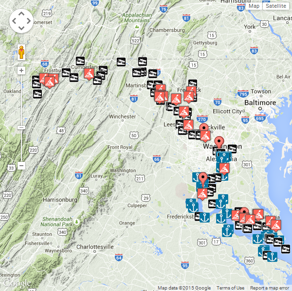
Tuesday, August 18, 2015

Pittsburgh-to-Harrisburg Main Line Canal Greenway


An illustrious past, a vibrant future – the Pittsburgh-to-Harrisburg Main Line Canal Greenway™ illustrates the Main Line Canal’s legacy, preserving the heritage of the people and places that make Pennsylvania unique, offering a vivid exploration of the Commonwealth’s past and its contributions to our nation.

History of the Canal

History of the Main Line Canal Greenway

Even after a more than two hundred years of industrial activity in its various incarnations, western Pennsylvania is still a wild and scenic place. It’s difficult to imagine what things used to be like before today’s highways, bridges, and railroads made it possible to zip from one ridge or valley to the next.

The rugged topography which proved to be well-suited for coal extraction and the steep forests with seemingly endless timber supplies were formidable obstacles of yesteryear.

The 2400-foot tall Allegheny Ridge (also called the Allegheny Front) was the most formidable of these barriers, until the era of Pennsylvania’s first major transportation improvement - the historic Pennsylvania Main Line Canal. Completed in 1834, the Pennsylvania Main Line Canal System paved the way for expansion westward from Philadelphia, across the Alleghenies to Pittsburgh, and beyond.

A way of life sprang up along this corridor as Pennsylvania prepared for a century of nation-building. Communities along the route shared a common legacy. The Pittsburgh-to-Harrisburg Main Line Canal Greenway™ is the next chapter in this story.

Get out and view the history for yourself!

For more information on Pennsylvania’s historic canals go to the PA Canal Society.


Currently, the Main Line Canal Greenway corridor is not designed as a single, long distance trail for unimpeded travel between Pittsburgh and Harrisburg. However, a network of land and water trails enable locals and visitors alike to experience portions of the Greenway, it’s landscape, communities, and historic and cultural assets.

Learn more about the Water Trails in the Main Line Canal Greenway.

Check out our Bike Trail Information.

Experience the Heritage and History of the Main Line Canal Greenway.

Have a look at the Main Line Canal Greenway Geo Trail.


Welcome to our Region of Trails!
 
Here in the heart of Pennsylvania’s Allegheny Mountains, the Trans Allegheny Trails are a system of rail-trails – with attitude. Parts of them are almost level, while other sections are downright challenging. That’s part of the fun for riders who like to get their hearts pumping and don’t mind breaking a sweat.  

You don’t have to be that kind of rider to enjoy the Trans Allegheny Trails, though! Most sections are typical rail-trail (less than 3% grade) and run through some of the Alleghenies’ most beautiful scenery.

And these trails have all of the historic character of the Alleghenies themselves. You’ll see:
  • The oldest railroad tunnel in America
  • A flood-control dam
  • Iron furnaces
  • Picturesque bridges
  • Amazing stonework
  • Old tow paths
  • The watercourse of a historic flood.
This website explores all of that and more! Whether you are a hard or easy rider, you’ll find trails that suit your style. Come for a day, a weekend or a week! Tools here will help you to decide which trails to ride, build an itinerary, get directions, interactive maps and find the necessary amenities of bike shops, food and lodging.

Find a Trail


Along the Three Rivers Heritage Trail and Three Rivers Water Trail
Along the Trans Allegheny Trails and Kiski-Conemaugh Water Trail
Along the Trans Allegheny Trails and Juniata River Water Trail
Along the Susquehanna River Water Trails (Duncannon to Harrisburg)
Statewide Historic Resources

Johnstown-to-Huntingdon Route 22 Artisan Trail


heART of the Alleghenies is a driving route of approximately 90 miles between Johnstown and Huntingdon. This corridor in Cambria, Blair, and Huntingdon counties winds through a myriad of historical rural communities once part of the historic Main Line Canal. Today, these communities remain connected by Route 22, hiking, biking, and water trails, and a rich cultural legacy. heART of the Alleghenies is the fruition of ARCorp's vision to incorporate art into the Pittsburgh-to-Harrisburg Main Line Canal Greenway™.

The Allegheny Ridge Corporation with its partners the Huntingdon County Arts Council, the Huntingdon County Visitors Bureau, the Bottle Works Ethnic Arts Center, and The Center for Turning and Furniture Design, department of Art, Indiana University of Pennsylvania have established the project area, have attended various workshops organized by Pennsylvania Council of the Arts (PCA) and the Department of Community and Economic Development (DCED), and have met with neighboring Artisan Trails to gain from their experience and insight. Several concepts for identity were explored and the final logo and tagline were adopted. The final concept caught the eye of the Allegheny Mountains Convention and Visitors Bureau and they signed on as a partner. The artist and artisan roster has been developed for Indiana, Cambria, Westmoreland, Allegheny, Blair, Huntingdon, Juniata, and Mifflin Counties.

heART of the Alleghenies is an opportunity for the artistic heritage and traditions of the region to be presented to the public and made available for purchase along a driving route approximately 90 miles long between Johnstown and Huntingdon. This project aims to increase awareness of the region's rich artistic heritage and stimulate tourism in the region.


heART of the Alleghenies is a unique driving experience along Route 22. Strategically placed commissioned art at high impact locales has the potential to entice a per day average of approximately 25,000 drivers. Cambria, Blair, and Huntingdon Counties are in The Alleghenies tourism region. The Brand promise is that The Alleghenies will connect you with the triumphant heritage of the community and the triumphant nature of your soul. heART of the Alleghenies is consistent with that promise and plans in its delivery by adding to the brand experience. The drive along Route 22 contains scenic vistas of rolling countryside and quaint hamlets and will be made more distinct by the insertion of unique retail opportunities. The brand memory is potentially reinforced by purchased products. The visitor receives a pleasurable experience traveling through the region and feels good about it. Dining and lodging options add to their enjoyment.

Prince Gallitzin State Park


At Prince Gallitzin State Park, the forested hills of the Allegheny Plateau cradle sprawling Glendale Lake in Cambria County. Vistas offer scenic views of the 1,635-acre lake with its 26 miles of shoreline, which is a favorite of anglers and boaters. Campers flock to the large campground and also enjoy hiking and other outdoor activities. The varied habitats of the park make it a home for many types of wildlife, and a rest stop in the spring and fall migrations.


Hiking   -  Biking   -  Mountain Biking   -  Horseback Riding   -  Picnicking   -  Swimming   -  Boating   -  Fishing   -  Hunting   -  Disc Golfing   -  Orienteering   -  Education   -  Cross-country Skiing   -  Snowmobiling   -  Ice Fishing   -  Iceboating   -  Organized Group Tenting   -  Cabins   -  Camping Cottages   -  Camping

Picnicking: Picnic tables are available throughout the park.

Many picnic tables are adjacent to the swimming area in Muskrat Beaches 1, 2 and 3. Four picnic pavilions may be reserved up to 11 months in advance for a fee. Unreserved picnic pavilions are free on a first-come, first-served basis.


Families swim, sunbathe and fly a kite at Muskrat Beach at Prince Gallitzin State Park, Pennsylvania. 

Swimming: Muskrat beach is open from late-May to mid-September, 8 a.m. to sunset. Swim at your own risk. Please read and follow posted rules for swimming. A food concession, modern bathhouses, dressing rooms, disc golf, volleyball courts and a large picnic area are in and around the swimming area. Campers can swim at the Beach Campground in the campground.

Explore swimming for more information.


Boating: up to 20 hp motors permitted

The 1,635-acre Glendale Lake has nine public boat launching areas conveniently located throughout the park, along with three public mooring facilities for sailboats, pontoon boats and runabouts. Marina slips are available at Beaver Valley and at Prince Gallitzin marinas. A watercraft concession and marina provides various services, including: watercraft rentals, lake tours, repairs to boats and motors, and the sale of fuel.

Motorboats must display a current boat registration. Non-powered boats must display one of the following: boat registration; launching permit or mooring permit from Pennsylvania State Parks, available at most state park offices; launching permit from the Pennsylvania Fish and Boat Commission.

Pennsylvania Fish and Boat Commission laws apply. Complete information on boating rules and regulations in Pennsylvania is available from the Pennsylvania Fish and Boat Commission Web site.

2015 Boat Rental Fees
https://www.facebook.com/236874473003711/photos/pb.236874473003711.-2207520000.1439938887./782168501807636/?type=1&theater

Visit the U. S. Geological Survey Web site for the water level of Glendale Lake. http://waterdata.usgs.gov/pa/nwis/uv/?site_no=01541340&PARAmeter_cd=00062


The ADA symbol indicates that this activity or structure is ADA accessible.Men fish in a bass boat while a pontoon boat passes on Glendale Lake at Prince Gallitzin State Park, Pennsylvania. 

Fishing: The 1,635-acre Glendale Lake is a warm-water fishery with bass, pike and muskellunge as the most common game fish. There is also a good population of panfish that includes crappie, bluegill and perch. Killbuck Run is stocked with trout. A fishing pier for people with disabilities is at Pickerel Pond.

Pennsylvania Fish and Boat Commission laws apply. Complete information on fishing rules and regulations in Pennsylvania is available from the Pennsylvania Fish and Boat Commission Web site.


The ADA symbol indicates that this activity or structure is ADA accessible.Hunting and Firearms: About 5,900 acres are open to hunting, trapping and the training of dogs during established seasons. Common game species are deer, turkey and small game.

Hunting woodchucks, also known as groundhogs, is prohibited. Dog training is only permitted from the day following Labor Day through March 31 in designated hunting areas. The Department of Conservation and Natural Resources and the Pennsylvania Game Commission rules and regulations apply. Contact the park office for ADA accessible hunting information.

Use extreme caution with firearms at all times. Other visitors use the park during hunting seasons. Firearms and archery equipment used for hunting may be uncased and ready for use only in authorized hunting areas during hunting seasons. In areas not open to hunting or during non-hunting seasons, firearms and archery equipment shall be kept in the owner's car, trailer or leased campsite. Exceptions include: law enforcement officers and individuals with a valid Pennsylvania License to Carry Firearms are authorized to carry a firearm concealed on their person while they are within a state park.

Complete information on hunting rules and regulations in Pennsylvania is available from the Pennsylvania Game Commission Web site.


Hiking: 32.65 miles of trails

The trails pass through many habitats and near the lake. For trail descriptions explore trails.


Biking: 2.3 miles of trails

All bicyclists may use park roads open to public travel. Campers may cycle the 2.3-mile multi-use trail around the perimeter of the campground. For an around-the-park road tour, go to www.theAlleghenies.com. Follow the link to Cycling, Cycling on Road, Choose a Tour, Marina Mania tour.


Mountain Biking: 20 miles of trails

In the northern part of the park, the 20-mile snowmobile trail network is open for mountain biking and hiking. Bikers should follow the rules of the road and common courtesies.

For more information on mountain biking, contact the park office or www.theAlleghenies.com. Follow the link to Mountain Biking, Choose a Tour, Killbuck Run tour. The Web site has maps, que sheets and additional information.


Horseback Riding: All equestrian trails can be accessed from the Beaverdam Boat Launch.
 
A riding stable adjacent to park property on Marina Road offers rides of varying degrees of difficulty and length on park property.


Disc Golfing: A nine-hole disc golf course is located around the Muskrat Beach #2 day use area.

The course wraps through varied terrain and provides challenging shots in wooded and field areas. Score cards and course maps can be picked up at the bulletin board at the far right of the parking area next to Tee #1. Scenic views of Glendale Lake and surrounding areas of the park provide a tranquil place to recreate after disc golfing.


Orienteering: The three level orienteering course consisting of 30 control points around the Muskrat Beach Area is great for both new and advanced orienteers.

Course levels begin at “Beginner” then progress to “Intermediate” and “Advanced”. Course maps, control cards, and answer codes may be picked up at the Prince Gallitzin Main Office lobby area. The course is a partnership between Prince Gallitzin State Park and the Western Pennsylvania Orienteering Club.
www.wpoc.org


Stay the Night


The ADA symbol indicates that this activity or structure is ADA accessible.Camping: flush toilets, warm showers, some electric hook-ups

A family enjoys camping in a tent at Prince Gallitzin State Park, Pennsylvania.

A 398-site tent and trailer campground is open from the second Friday in April to the last Monday in October. Facilities and services offered in the campground include: camp store with coin-operated laundry, swimming beach, boat mooring area, boat rental, playgrounds, paved sites, showers, flush toilets and sanitary dump stations. The Campground Beach is open in the summer.

Explore the campground map.

Explore camping for more information.


Free Camping for Campground Hosts: 7 host positions

The campground host sites have amenities that include 50-amp electric service and water and sewer hookup. The Crooked Run Campground has host sites on each of seven main loops that have 43 to 84 campsites each. Each loop has its own washhouse. The host is required to assist park personnel for 40 hours per week with a two-week minimum stay. On the loop or loops assigned, host responsibilities include light maintenance tasks at campsites, litter pickup, evening checks of washhouses, and promoting good public relations with campers. Some loops are closed seasonally, reducing the number of hosts needed in the spring and fall. Contact the park office for additional information and availability.


The ADA symbol indicates that this activity or structure is ADA accessible.Camping Cottages: The three camping cottages in the campground have a deck and windows that overlook the lake.

Each cottage sleeps five people in a single bunk and double/single bunk beds and has electric lights, outlets and heat. The cottages are available from the second Friday in April to the last Monday in October. One cottage is ADA accessible.


The ADA symbol indicates that this activity or structure is ADA accessible.Modern Cabins: Ten modern cabins are for rent year-round. Cabins are furnished and have a living area, kitchen/dining area, shower room, and two or three bedrooms. Two bedroom cabins sleep six people (one double bed and two bunks), while three bedroom cabins sleep eight people (one double bed and three bunks). Up to two dogs are permitted in Cabin 1 for a fee. In 2014, up to two dogs will be permitted in Cabin 10 for a fee. One cabin is ADA accessible.

Explore the cabin map.

Explore cabins for more information.


Organized Group Tenting: A rustic tenting area may be reserved by organized adult and youth groups from Memorial Day weekend through Labor Day. There are picnic tables, restrooms and drinking water. A shower house is within easy walking distance.

Explore organized group tenting for more information.


Winter Activities


Explore the Winter Report for the current snow and ice depths.


Cross-country Skiing: Seven miles of marked trails are available for this popular wintertime activity.


Snowmobiling: Registered snowmobiles may use the 20-mile trail network. Snowmobiles may be operated on designated trails and roads from the day following the last deer season in December until April 1, weather permitting.


Ice Fishing: The 1,635-acre Glendale Lake is popular for ice fishing. Common species caught through the ice are perch, walleye, pike and crappies. Ice thickness is not monitored. For your safety, be sure the ice is four inches thick and carry safety equipment.


Iceboating: Iceboats must display a state park launch permit.


Environmental Education and Interpretation


An environmental education specialist offers a wide variety of environmental education and interpretive programs year-round. Through hands-on activities, guided walks and programs, participants gain appreciation, understanding and develop a sense of stewardship toward the natural and cultural resources of the park. Recreational programming includes interpretive kayak and pontoon boat tours of Lake Glendale. Curriculum-based environmental education field learning experiences are available for K – 12 school groups, youth organizations and homeschool associations.

Explore the Calendar of Events for a listing of events from today forward.

Explore environmental education and interpretation for more information.


Access for People with Disabilities


The ADA symbol indicates that this activity or structure is ADA accessible.If you need an accommodation to participate in park activities due to a disability, please contact the park you plan to visit.